
Strahan topographic map
Interactive map
Click on the map to display elevation.
About this map
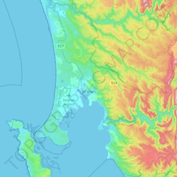
Name: Strahan topographic map, elevation, terrain.
Location: Strahan, West Coast, Tasmania, 7468, Australia (-42.27814 145.22231 -42.01827 145.54319)
Average elevation: 89 m
Minimum elevation: -3 m
Maximum elevation: 425 m