
Shaba National Reserve topographic map
Interactive map
Click on the map to display elevation.
About this map
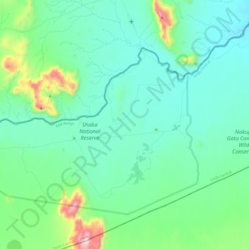
Name: Shaba National Reserve topographic map, elevation, terrain.
Location: Shaba National Reserve, Isiolo County, East Kenya, Kenya (0.59720 37.70566 0.74184 37.93940)
Average elevation: 852 m
Minimum elevation: 683 m
Maximum elevation: 1,616 m
Other topographic maps
Click on a map to view its topography, its elevation and its terrain.
Kubi Turkana
Kenya > Isiolo County > Kubi Turkana
Kubi Turkana, Isiolo County, East Kenya, Kenya
Average elevation: 730 m