
Ravensdale topographic map
Interactive map
Click on the map to display elevation.
Ravensdale
Ravensdale is a census-designated place (CDP) in King County, Washington, United States. The population was 1,101 at the 2010 census. It is in the Pacific Time Zone. The elevation is 623 feet (190 m).
About this map
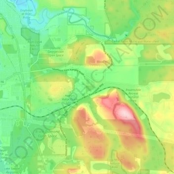
Name: Ravensdale topographic map, elevation, terrain.
Location: Ravensdale, King County, Washington, 98051, United States (47.33556 -122.01610 47.37635 -121.91712)
Average elevation: 209 m
Minimum elevation: 112 m
Maximum elevation: 366 m