
Shibden Park topographic map
Interactive map
Click on the map to display elevation.
About this map
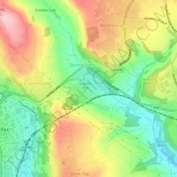
Name: Shibden Park topographic map, elevation, terrain.
Average elevation: 183 m
Minimum elevation: 86 m
Maximum elevation: 302 m
Other topographic maps
Click on a map to view its topography, its elevation and its terrain.
Lane Ends
United Kingdom > England > Calderdale > Stump Cross > Shibden Dale
Lane Ends, Shibden Dale, Stump Cross, Calderdale, West Yorkshire, England, HX3 7UW, United Kingdom
Average elevation: 221 m