
Southington topographic map
Interactive map
Click on the map to display elevation.
About this map
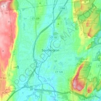
Name: Southington topographic map, elevation, terrain.
Location: Southington, Hartford County, Connecticut, United States (41.54471 -72.94635 41.65573 -72.81419)
Average elevation: 105 m
Minimum elevation: 32 m
Maximum elevation: 311 m