
Villalba topographic map
Interactive map
Click on the map to display elevation.
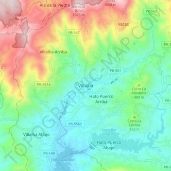
Villalba
Villalba is located in the central region of Puerto Rico, on a valley in the Cordillera Central. The highest point in the municipality is Cerro El Bolo at 3,526 feet (1,075 m) of elevation.
About this map
Name: Villalba topographic map, elevation, terrain.
Location: Villalba, Puerto Rico, 00766, United States (18.08835 -66.53250 18.16835 -66.45250)
Average elevation: 406 m
Minimum elevation: 97 m
Maximum elevation: 1,086 m