
Dahegaon topographic map
Interactive map
Click on the map to display elevation.
About this map
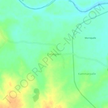
Name: Dahegaon topographic map, elevation, terrain.
Location: Dahegaon, Dahegaon mandal, Komram Bheem, Telangana, India (19.23757 79.69195 19.27757 79.73195)
Average elevation: 146 m
Minimum elevation: 134 m
Maximum elevation: 165 m