
Amerongen topographic map
Interactive map
Click on the map to display elevation.
About this map
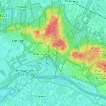
Name: Amerongen topographic map, elevation, terrain.
Location: Amerongen, Utrechtse Heuvelrug, Utrecht, Netherlands (51.97073 5.37839 52.03176 5.50340)
Average elevation: 15 m
Minimum elevation: 1 m
Maximum elevation: 72 m
Other topographic maps
Click on a map to view its topography, its elevation and its terrain.