
Courtételle topographic map
Interactive map
Click on the map to display elevation.
About this map
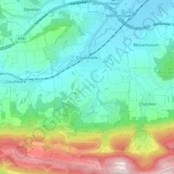
Name: Courtételle topographic map, elevation, terrain.
Location: Courtételle, District de Delémont, Jura, 2852, Switzerland (47.30588 7.29604 47.35961 7.33771)
Average elevation: 605 m
Minimum elevation: 416 m
Maximum elevation: 1,116 m