
Wycheproof topographic map
Interactive map
Click on the map to display elevation.
About this map
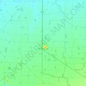
Name: Wycheproof topographic map, elevation, terrain.
Location: Wycheproof, Shire of Buloke, Victoria, 3527, Australia (-36.15701 143.14035 -35.97747 143.30890)
Average elevation: 107 m
Minimum elevation: 98 m
Maximum elevation: 142 m
Other topographic maps
Click on a map to view its topography, its elevation and its terrain.
Mount Wycheproof
Australia > Victoria > Wycheproof
Mount Wycheproof, Wycheproof, Shire of Buloke, Victoria, 3527, Australia
Average elevation: 110 m