
Kapeeka topographic map
Interactive map
Click on the map to display elevation.
About this map
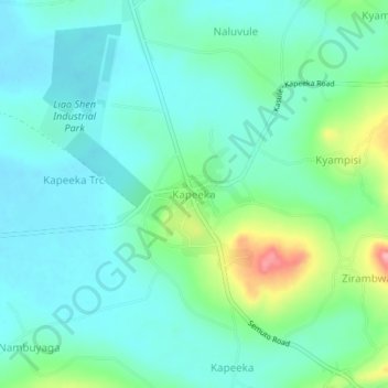
Name: Kapeeka topographic map, elevation, terrain.
Location: Kapeeka, Nakaseke, Central Region, Uganda (0.66151 32.22696 0.70151 32.26696)
Average elevation: 1,119 m
Minimum elevation: 1,089 m
Maximum elevation: 1,218 m