
Sirte topographic map
Interactive map
Click on the map to display elevation.
About this map
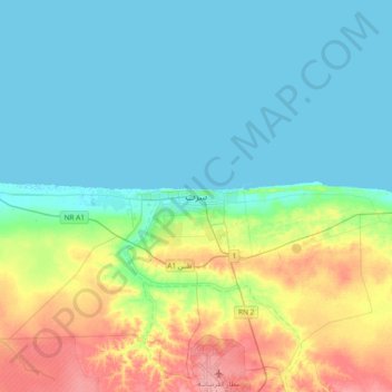
Name: Sirte topographic map, elevation, terrain.
Location: Sirte, Libya (31.04596 16.42362 31.36596 16.74362)
Average elevation: 23 m
Minimum elevation: -1 m
Maximum elevation: 88 m
Other topographic maps
Click on a map to view its topography, its elevation and its terrain.