
Higüey topographic map
Interactive map
Click on the map to display elevation.
About this map
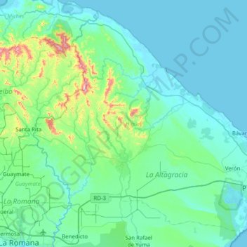
Name: Higüey topographic map, elevation, terrain.
Location: Higüey, La Altagracia, Dominican Republic (18.44139 -68.93768 18.97435 -68.32291)
Average elevation: 81 m
Minimum elevation: -2 m
Maximum elevation: 683 m
Other topographic maps
Click on a map to view its topography, its elevation and its terrain.