
Oxstedt topographic map
Interactive map
Click on the map to display elevation.
About this map
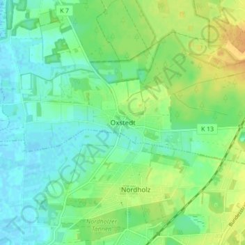
Name: Oxstedt topographic map, elevation, terrain.
Location: Oxstedt, Cuxhaven, Landkreis Cuxhaven, Lower Saxony, Germany (53.77686 8.59159 53.81686 8.63159)
Average elevation: 11 m
Minimum elevation: -2 m
Maximum elevation: 27 m