
Moonnilavu topographic map
Interactive map
Click on the map to display elevation.
About this map
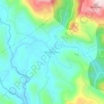
Name: Moonnilavu topographic map, elevation, terrain.
Location: Moonnilavu, Meenachil, Kottayam, Kerala, 686586, India (9.72839 76.76474 9.76839 76.80474)
Average elevation: 164 m
Minimum elevation: 22 m
Maximum elevation: 584 m
Other topographic maps
Click on a map to view its topography, its elevation and its terrain.