
Azra topographic map
Interactive map
Click on the map to display elevation.
About this map
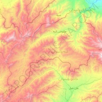
Name: Azra topographic map, elevation, terrain.
Location: Azra, Logar Province, Afghanistan (33.92816 69.38283 34.25731 69.88377)
Average elevation: 2,935 m
Minimum elevation: 1,460 m
Maximum elevation: 4,533 m
Other topographic maps
Click on a map to view its topography, its elevation and its terrain.
Charkh
Afghanistan > Logar Province > Charkh
Charkh, Logar Province, Afghanistan
Average elevation: 2,391 m