
Azra topographic map
Interactive map
Click on the map to display elevation.
About this map
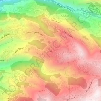
Name: Azra topographic map, elevation, terrain.
Average elevation: 674 m
Minimum elevation: 72 m
Maximum elevation: 1,099 m
Azra ou el-Azr (Arabic: العذرا والعذر; also spelled Aazra ouel Aazr or simply Azra) is a municipality located in the Keserwan District of the Mount Lebanon Governorate in Lebanon. The municipality, which consists of the villages of Azra and el-Azr, is about 39 kilometres (24 mi) north of Beirut. It has an average elevation of 750 meters above sea level, a total land area of 113 hectares and is bordered by the villages of Zaaitreh, Zeitoun, Mradiyeh, Jouret Bedran and Ghbaleh.