
Broadwater County topographic map
Interactive map
Click on the map to display elevation.
About this map
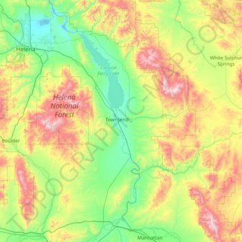
Name: Broadwater County topographic map, elevation, terrain.
Location: Broadwater County, Montana, United States (45.83759 -111.78807 46.78178 -111.05418)
Average elevation: 1,602 m
Minimum elevation: 1,110 m
Maximum elevation: 2,892 m
Other topographic maps
Click on a map to view its topography, its elevation and its terrain.
Winston
United States > Montana > Broadwater County > Winston
Winston, Broadwater County, Montana, 59647, United States
Average elevation: 1,335 m