
Repalle topographic map
Interactive map
Click on the map to display elevation.
About this map
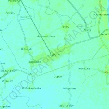
Name: Repalle topographic map, elevation, terrain.
Location: Repalle, Guntur, Andhra Pradesh, 522265, India (15.97917 80.79136 16.05917 80.87136)
Average elevation: 5 m
Minimum elevation: 2 m
Maximum elevation: 11 m
Repalle is located at 16°01′N 80°31′E / 16.01°N 80.51°E / 16.01; 80.51. It has an average elevation of 7 m (23 ft) and situated 10.62 km (6.60 mi). The nearest towns are Tenali, Bapatla in the Guntur district, and Machilipatnam in the Krishna district.