
Thengode topographic map
Interactive map
Click on the map to display elevation.
About this map
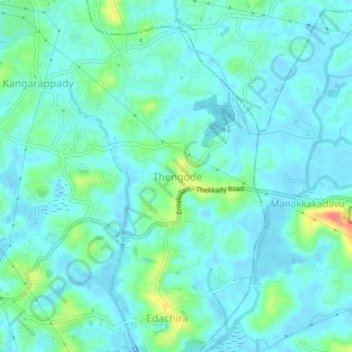
Name: Thengode topographic map, elevation, terrain.
Average elevation: 11 m
Minimum elevation: -6 m
Maximum elevation: 53 m
Other topographic maps
Click on a map to view its topography, its elevation and its terrain.
Kalamassery
Kalamassery, Thengode, Kanayannur, Ernakulam district, Kerala, India
Average elevation: 12 m