
Cuxhaven topographic map
Interactive map
Click on the map to display elevation.
About this map
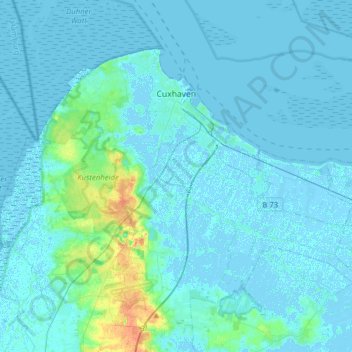
Name: Cuxhaven topographic map, elevation, terrain.
Location: Cuxhaven, Landkreis Cuxhaven, Niedersachsen, Deutschland (53.75888 8.55202 53.89229 8.86391)
Average elevation: 3 m
Minimum elevation: -4 m
Maximum elevation: 31 m
Höchste Erhebung im Stadtgebiet ist die Altenwalder Höhe (37,5 m ü. NN); früher Standort der Altenwalder Burg auf einem altsächsischen Gräberfeld.