
Avesta kommun topographic map
Interactive map
Click on the map to display elevation.
About this map
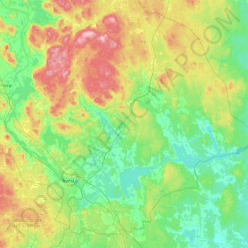
Name: Avesta kommun topographic map, elevation, terrain.
Location: Avesta kommun, Dalarna County, Sweden (60.06988 16.01699 60.37940 16.70460)
Average elevation: 118 m
Minimum elevation: 56 m
Maximum elevation: 272 m
Other topographic maps
Click on a map to view its topography, its elevation and its terrain.