
Borgvattnet topographic map
Interactive map
Click on the map to display elevation.
About this map
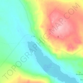
Name: Borgvattnet topographic map, elevation, terrain.
Location: Borgvattnet, Ragunda kommun, Jämtland County, 844 95, Sweden (63.40318 15.80567 63.44318 15.84567)
Average elevation: 396 m
Minimum elevation: 343 m
Maximum elevation: 489 m