
Gladbeck topographic map
Interactive map
Click on the map to display elevation.
About this map
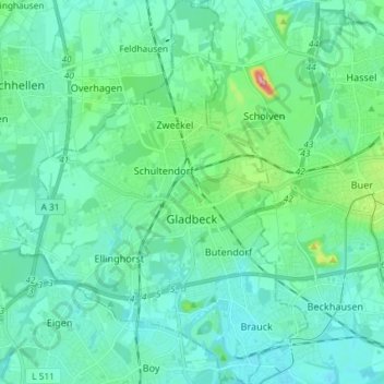
Name: Gladbeck topographic map, elevation, terrain.
Location: Gladbeck, Kreis Recklinghausen, North Rhine-Westphalia, Germany (51.53267 6.92086 51.62360 7.03212)
Average elevation: 55 m
Minimum elevation: 27 m
Maximum elevation: 198 m
Other topographic maps
Click on a map to view its topography, its elevation and its terrain.
Datteln
Germany > North Rhine-Westphalia > Kreis Recklinghausen
Datteln, Kreis Recklinghausen, North Rhine-Westphalia, 45711, Germany
Average elevation: 61 m
Lembeck
Germany > North Rhine-Westphalia > Kreis Recklinghausen > Dorsten
Lembeck, Dorsten, Kreis Recklinghausen, North Rhine-Westphalia, 46286, Germany
Average elevation: 67 m
Recklinghausen
Germany > North Rhine-Westphalia > Kreis Recklinghausen
Recklinghausen, Kreis Recklinghausen, North Rhine-Westphalia, Germany
Average elevation: 70 m