Geolocate

Ras Nakhreir topographic map

Interactive map

Click on the map to display elevation.

About this map

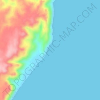
Name: Ras Nakhreir topographic map, elevation, terrain.

Location: Ras Nakhreir, Al Wusta Governorate, Oman (19.97000 57.80000 19.99000 57.82000)

Average elevation: 42 m

Minimum elevation: -2 m

Maximum elevation: 163 m

Other topographic maps

Click on a map to view its topography, its elevation and its terrain.

Khahil

Oman > Al Wusta Governorate

Khahil, Al Wusta Governorate, Oman

Average elevation: 10 m

Duqm

Oman > Al Wusta Governorate

Duqm, Al Wusta Governorate, Oman

Average elevation: 52 m

Haima

Oman > Al Wusta Governorate

Haima, Al Wusta Governorate, Oman

Average elevation: 131 m