
Kaneri Lake topographic map
Interactive map
Click on the map to display elevation.
About this map
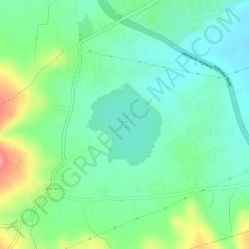
Name: Kaneri Lake topographic map, elevation, terrain.
Location: Kaneri Lake, Kolhapur, Kolhapur district, Maharashtra, India (16.62211 74.27567 16.63099 74.28442)
Average elevation: 614 m
Minimum elevation: 582 m
Maximum elevation: 674 m
Other topographic maps
Click on a map to view its topography, its elevation and its terrain.
Takala Lake
India > Maharashtra > Kolhapur
Takala Lake, Takala, Shivaji Park, Kolhapur, Kolhapur district, Maharashtra, India
Average elevation: 567 m