
Thank you for supporting this site ❤️
Make a donation
Make a donation
Gear up for your next adventure:
As an Amazon Associate, this site earns from qualifying purchases at no extra cost to you.
Priorato topographic map
Click on the map to display elevation.
Thank you for supporting this site ❤️
Make a donation
Make a donation
Gear up for your next adventure:
As an Amazon Associate, this site earns from qualifying purchases at no extra cost to you.
About this map
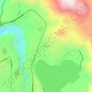
Name: Priorato topographic map, elevation, terrain.
Location: Priorato, Ibarra, Imbabura, 100110, Ecuador (0.36565 -78.12578 0.40565 -78.08578)
Average elevation: 2,265 m
Minimum elevation: 1,875 m
Maximum elevation: 2,817 m
Thank you for supporting this site ❤️
Make a donation
Make a donation
Gear up for your next adventure:
As an Amazon Associate, this site earns from qualifying purchases at no extra cost to you.