
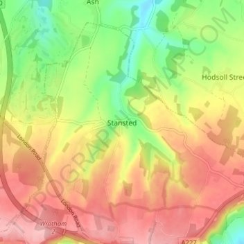
Stansted topographic map
Interactive map
Click on the map to display elevation.
About this map
Name: Stansted topographic map, elevation, terrain.
Location: Stansted, Kent, South East, England, TN15 7PP, United Kingdom (51.31549 0.28549 51.35549 0.32549)
Average elevation: 175 m
Minimum elevation: 104 m
Maximum elevation: 236 m