
Poulton-le-Fylde topographic map
Interactive map
Click on the map to display elevation.
About this map
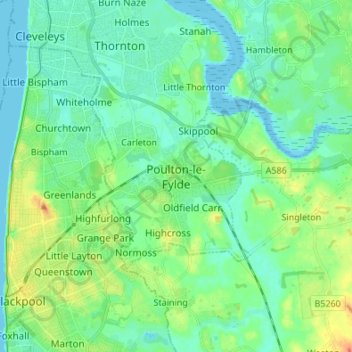
Name: Poulton-le-Fylde topographic map, elevation, terrain.
Average elevation: 12 m
Minimum elevation: -2 m
Maximum elevation: 43 m
Lancashire trails, hiking, mountain biking, running and outdoor activities
Other topographic maps
Click on a map to view its topography, its elevation and its terrain.
Preesall
United Kingdom > England > Lancashire > Borough of Wyre > Knott End-On-Sea
Average elevation: 3 m