
Horsley Hills topographic map
Interactive map
Click on the map to display elevation.
About this map
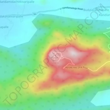
Name: Horsley Hills topographic map, elevation, terrain.
Location: Horsley Hills, B. Kothakota, Chittoor, Andhra Pradesh, India (13.63087 78.37653 13.67087 78.41653)
Average elevation: 898 m
Minimum elevation: 701 m
Maximum elevation: 1,295 m