
Dalat topographic map
Interactive map
Click on the map to display elevation.
About this map
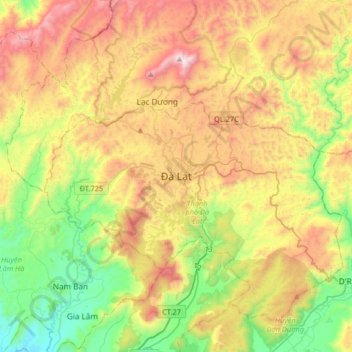
Name: Dalat topographic map, elevation, terrain.
Location: Dalat, Đà Lạt District, Lâm Đồng Province, 6700, Vietnam (11.78024 108.27758 12.10024 108.59758)
Average elevation: 1,360 m
Minimum elevation: 832 m
Maximum elevation: 2,093 m