
Thank you for supporting this site ❤️
Make a donation
Make a donation
Gear up for your next adventure:
As an Amazon Associate, this site earns from qualifying purchases at no extra cost to you.
Freetown topographic map
Click on the map to display elevation.
Thank you for supporting this site ❤️
Make a donation
Make a donation
Gear up for your next adventure:
As an Amazon Associate, this site earns from qualifying purchases at no extra cost to you.
About this map
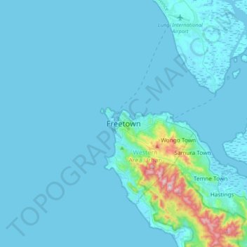
Name: Freetown topographic map, elevation, terrain.
Location: Freetown, Western Area Urban, Western Area, Sierra Leone (8.31900 -13.42795 8.63900 -13.10795)
Average elevation: 48 m
Minimum elevation: -3 m
Maximum elevation: 767 m
Thank you for supporting this site ❤️
Make a donation
Make a donation
Gear up for your next adventure:
As an Amazon Associate, this site earns from qualifying purchases at no extra cost to you.