
Sarkaghat topographic map
Interactive map
Click on the map to display elevation.
About this map
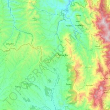
Name: Sarkaghat topographic map, elevation, terrain.
Location: Sarkaghat, Mandi, Himachal Pradesh, India (31.60151 76.62094 31.79816 76.78349)
Average elevation: 1,050 m
Minimum elevation: 640 m
Maximum elevation: 2,004 m