
Decatur County topographic map
Interactive map
Click on the map to display elevation.
About this map
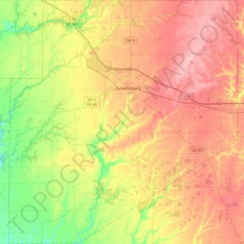
Name: Decatur County topographic map, elevation, terrain.
Location: Decatur County, Indiana, United States (39.13067 -85.68800 39.45338 -85.29614)
Average elevation: 275 m
Minimum elevation: 212 m
Maximum elevation: 335 m
Other topographic maps
Click on a map to view its topography, its elevation and its terrain.
Greensburg
United States > Indiana > Decatur County
Greensburg, Decatur County, Indiana, United States
Average elevation: 288 m