
Aiken topographic map
Interactive map
Click on the map to display elevation.
About this map
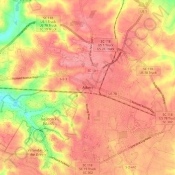
Name: Aiken topographic map, elevation, terrain.
Location: Aiken, Aiken County, South Carolina, 29801, United States (33.51986 -81.76195 33.59986 -81.68195)
Average elevation: 143 m
Minimum elevation: 77 m
Maximum elevation: 173 m