
Chevarambalam topographic map
Interactive map
Click on the map to display elevation.
About this map
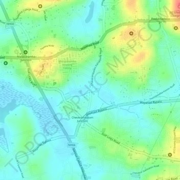
Name: Chevarambalam topographic map, elevation, terrain.
Average elevation: 23 m
Minimum elevation: 3 m
Maximum elevation: 60 m
Other topographic maps
Click on a map to view its topography, its elevation and its terrain.
Vellimadukunnu
India > Kerala > Kozhikode > Kozhikode
Vellimadukunnu, Kozhikode, Kozhikode District, Kerala, India
Average elevation: 27 m
Velliparamba
India > Kerala > Kozhikode > Kozhikode > Velliparamba
Velliparamba, Kozhikode, Kozhikode district, Kerala, 673 016, India
Average elevation: 30 m