
Signal de Botrange topographic map
Interactive map
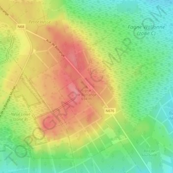
Click on the map to display elevation.
About this map
Name: Signal de Botrange topographic map, elevation, terrain.
Average elevation: 658 m
Minimum elevation: 616 m
Maximum elevation: 701 m
In 1923, the 6-metre (20-foot) Baltia tower was built on the summit to allow visitors to reach an altitude of 700 m (2,300 ft). A stone tower built in 1933/34 by François Fagnoul from Ovifat on the Botrange crowned a steel weather vane with the relieved name SICCO CAMPO until World War II. Meanwhile, the spire serves as transmitter of Radio Contact and reaches a de facto height of 718 m (2,356 ft).
Other topographic maps
Click on a map to view its topography, its elevation and its terrain.
Ardennes
Belgium > Liège > Verviers > Robertville
Ardennes, Robertville, Waimes, Verviers, Liège, Wallonia, Belgium
Average elevation: 659 m
Ovifat
Belgium > Liège > Verviers > Robertville
Ovifat, Robertville, Waimes, Verviers, Liège, Wallonia, Belgium
Average elevation: 591 m