
Uden topographic map
Interactive map
Click on the map to display elevation.
About this map
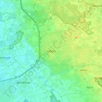
Name: Uden topographic map, elevation, terrain.
Location: Uden, Maashorst, North Brabant, Netherlands, 5401GS, Netherlands (51.61909 5.57486 51.69909 5.65486)
Average elevation: 16 m
Minimum elevation: 8 m
Maximum elevation: 29 m