
Port Alsworth topographic map
Interactive map
Click on the map to display elevation.
About this map
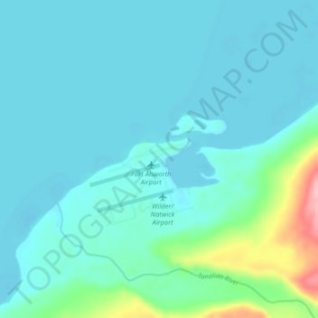
Name: Port Alsworth topographic map, elevation, terrain.
Average elevation: 93 m
Minimum elevation: 74 m
Maximum elevation: 210 m
Other topographic maps
Click on a map to view its topography, its elevation and its terrain.
Aniakchak National Monument
United States > Alaska > Lake and Peninsula
Aniakchak National Monument, Lake and Peninsula, Alaska, United States
Average elevation: 376 m
Alagnak River
United States > Alaska > Lake and Peninsula
Alagnak River, Lake and Peninsula, Alaska, United States
Average elevation: 16 m
Lake Clark
United States > Alaska > Lake and Peninsula
Lake Clark, Lake and Peninsula, Alaska, United States
Average elevation: 477 m
Nondalton
United States > Alaska > Lake and Peninsula
Nondalton, Lake and Peninsula, Alaska, 99640, United States
Average elevation: 138 m