
Manas National Park topographic map
Interactive map
Click on the map to display elevation.
About this map
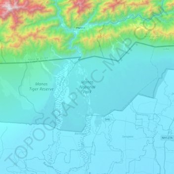
Name: Manas National Park topographic map, elevation, terrain.
Location: Manas National Park, Bijni (Pt), Chirang, Assam, India (26.62312 90.80811 26.82178 91.23718)
Average elevation: 276 m
Minimum elevation: 41 m
Maximum elevation: 2,256 m