
Lebanon topographic map
Interactive map
Click on the map to display elevation.
About this map
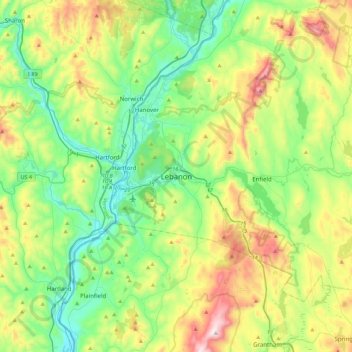
Name: Lebanon topographic map, elevation, terrain.
Average elevation: 315 m
Minimum elevation: 87 m
Maximum elevation: 808 m
Other topographic maps
Click on a map to view its topography, its elevation and its terrain.
West Lebanon
United States > New Hampshire > Grafton County > Lebanon > West Lebanon
West Lebanon, Lebanon, Grafton County, New Hampshire, 03784, United States
Average elevation: 165 m
LeBruns Mobile Home Park
United States > New Hampshire > Grafton County > Lebanon > LeBruns Mobile Home Park
LeBruns Mobile Home Park, Lebanon, Grafton County, New Hampshire, United States
Average elevation: 326 m