
Clearwater County topographic map
Interactive map
Click on the map to display elevation.
About this map
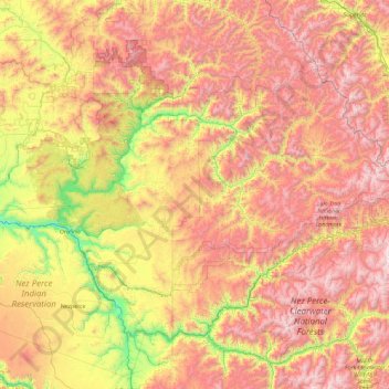
Name: Clearwater County topographic map, elevation, terrain.
Location: Clearwater County, Idaho, United States (46.26543 -116.45614 46.93450 -114.59463)
Average elevation: 1,250 m
Minimum elevation: 269 m
Maximum elevation: 2,448 m
Other topographic maps
Click on a map to view its topography, its elevation and its terrain.
Orofino
United States > Idaho > Clearwater County
Orofino, Clearwater County, Idaho, 83544, United States
Average elevation: 633 m
Platinum Lake
United States > Idaho > Clearwater County
Platinum Lake, Clearwater County, Idaho, United States
Average elevation: 1,723 m