
Saline County topographic map
Interactive map
Click on the map to display elevation.
About this map
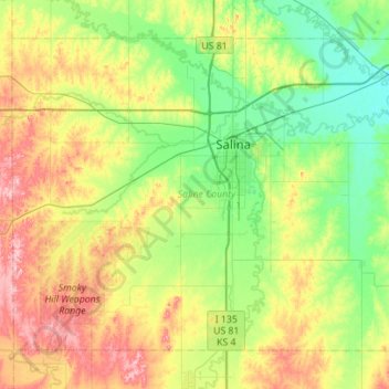
Name: Saline County topographic map, elevation, terrain.
Location: Saline County, Kansas, United States (38.60935 -97.92866 38.95851 -97.37162)
Average elevation: 406 m
Minimum elevation: 355 m
Maximum elevation: 506 m
Other topographic maps
Click on a map to view its topography, its elevation and its terrain.
Gypsum
United States > Kansas > Saline County
Gypsum, Saline County, Kansas, United States
Average elevation: 378 m
Salina
United States > Kansas > Saline County
Salina, Saline County, Kansas, 67401, United States
Average elevation: 383 m