
Padlam topographic map
Interactive map
Click on the map to display elevation.
About this map
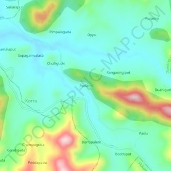
Name: Padlam topographic map, elevation, terrain.
Location: Padlam, Dumbriguda, Visakhapatnam, Andhra Pradesh, India (18.20032 82.80643 18.24032 82.84643)
Average elevation: 1,049 m
Minimum elevation: 960 m
Maximum elevation: 1,292 m