
Lamar County topographic map
Interactive map
Click on the map to display elevation.
About this map
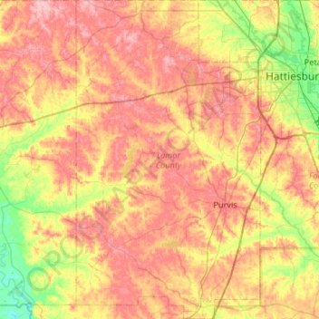
Name: Lamar County topographic map, elevation, terrain.
Location: Lamar County, Mississippi, United States (30.98245 -89.65427 31.43398 -89.34762)
Average elevation: 86 m
Minimum elevation: 25 m
Maximum elevation: 143 m
Other topographic maps
Click on a map to view its topography, its elevation and its terrain.
West Hattiesburg
United States > Mississippi > Lamar County > Hattiesburg
West Hattiesburg, Hattiesburg, Lamar County, Mississippi, United States
Average elevation: 73 m
Sumrall
United States > Mississippi > Lamar County
Sumrall, Lamar County, Mississippi, United States
Average elevation: 96 m