
Guadix topographic map
Interactive map
Click on the map to display elevation.
About this map
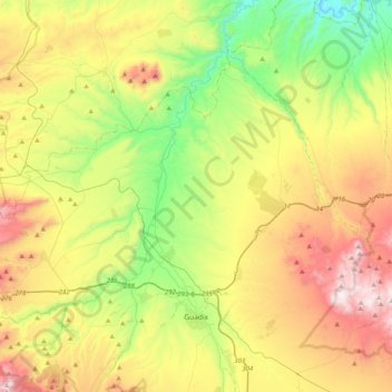
Name: Guadix topographic map, elevation, terrain.
Location: Guadix, Comarca de Guadix, Granada, Andalusia, Spain (37.23862 -3.26153 37.56132 -2.93718)
Average elevation: 1,043 m
Minimum elevation: 555 m
Maximum elevation: 1,763 m
The city lies at an altitude of 913 metres,[2] on the centre of the Hoya of Guadix, a high plain at the northern foothills of the Sierra Nevada. It is located on the Madrid-Valdepeñas-Almería railway.
Other topographic maps
Click on a map to view its topography, its elevation and its terrain.
La Calahorra
Spain > Andalusia > Comarca de Guadix
La Calahorra, Comarca de Guadix, Granada, Andalusia, Spain
Average elevation: 1,148 m
Purullena
Spain > Andalusia > Comarca de Guadix > Purullena
Purullena, Comarca de Guadix, Granada, Andalusia, 18519, Spain
Average elevation: 900 m