
Batrojkhan topographic map
Interactive map
Click on the map to display elevation.
About this map
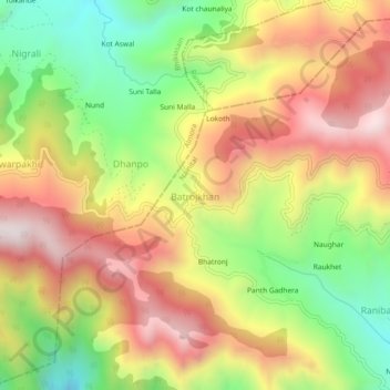
Name: Batrojkhan topographic map, elevation, terrain.
Average elevation: 1,520 m
Minimum elevation: 1,100 m
Maximum elevation: 1,926 m
Other topographic maps
Click on a map to view its topography, its elevation and its terrain.
Darima
India > Uttarakhand > Betalghat > Rataura
Darima, Rataura, Betalghat, Nainital District, Uttarakhand, India
Average elevation: 1,114 m