
Llangrannog topographic map
Interactive map
Click on the map to display elevation.
About this map
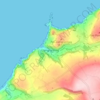
Name: Llangrannog topographic map, elevation, terrain.
Location: Llangrannog, Ceredigion, Wales, SA44 6SQ, United Kingdom (52.13901 -4.48653 52.17901 -4.44653)
Average elevation: 77 m
Minimum elevation: 0 m
Maximum elevation: 237 m