
Tucker topographic map
Interactive map
Click on the map to display elevation.
About this map
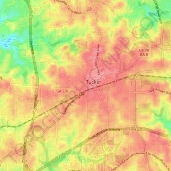
Name: Tucker topographic map, elevation, terrain.
Location: Tucker, DeKalb County, Georgia, 30084, United States (33.81841 -84.25263 33.88497 -84.17313)
Average elevation: 317 m
Minimum elevation: 267 m
Maximum elevation: 344 m
Tucker, at 1,117 feet (340 m) feet above sea level, is the highest point of elevation on the railroad line between Atlanta and Richmond, Virginia.