
Marta topographic map
Interactive map
Click on the map to display elevation.
About this map
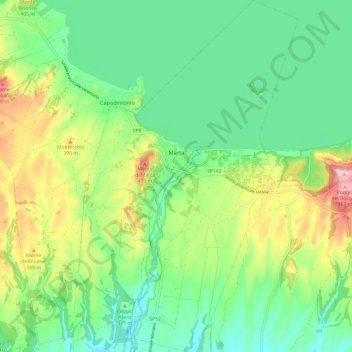
Name: Marta topographic map, elevation, terrain.
Location: Marta, Viterbo, Lazio, Italy (42.48375 11.89153 42.57222 11.96657)
Average elevation: 330 m
Minimum elevation: 262 m
Maximum elevation: 468 m